Beskrivelse
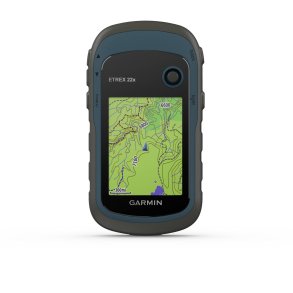
Garmin eTrex Touch GPS Handheld Device with Touch Display
For navigation away from marked paths, the device offers extensive mapping features, modern satellite technology and long battery life. The 3-inch colour display clearly shows maps, routes and navigation data and remains easy to read even in bright sunlight thanks to its transflective technology.
Reliable navigation with multiple satellite systems
Support for GPS, GLONASS, Galileo, QZSS, BeiDou and IRNSS provides access to many positioning sources. Multiband frequency technology helps deliver accurate positioning, even in challenging environments. A barometric altimeter and electronic compass further support navigation.
Comprehensive maps for outdoor use
Pre-installed TopoActive maps are included and support route guidance. Additional maps can also be added. Satellite imagery can be used through Outdoor Maps+, while numerous points of interest as well as information on parks and nature areas help with orientation.
Long-lasting performance for extended trips
The integrated lithium-ion battery provides up to 130 hours of runtime when using all satellite systems and multiband technology. In expedition mode, up to 650 hours are possible. The internal 32 GB memory offers space for maps, waypoints and recorded activities.
Connected and versatile
Wireless connections via WiFi, BLE and ANT allow connection to compatible services and applications. Features such as LiveTrack, Geocaching Live and support for the Garmin Explore app expand the possible uses. A USB-C connection is available for compatible devices.
Features:
- Chemically strengthened display glass increases durability for outdoor use
- 3-inch transflective TFT colour display supports good readability in different lighting conditions
- Touchscreen allows direct and convenient control of the map view
- Multiband frequencies improve positioning in challenging environments
- Support for GPS, GLONASS, Galileo, QZSS, BeiDou and IRNSS ensures broad satellite coverage
- Barometric altimeter provides additional altitude information while travelling
- Electronic compass supports orientation during navigation
- Pre-installed TopoActive maps allow immediate use without additional map installation
- Automatic route guidance supports road navigation with turn-by-turn directions
- Up to 15,000 map segments provide extensive map usage
- Satellite imagery can be added through Outdoor Maps+
- Unlimited waypoints, routes and activities offer high flexibility for planning
- 32 GB storage capacity allows maps and navigation data to be stored
- LiveTrack allows location information to be shared
- Geocaching Live supports searching for geocaches directly on the device
- Support for up to 500 custom map tiles through Custom Maps
- Wireless connectivity via WiFi, BLE and ANT simplifies data transfer
- IP67 protection supports use in demanding environmental conditions